After I left Golden Spike National Historic Site, I headed southward, on the west side of the Promontory Mountains. I reached the shoreline, but a gate on private land prevented me from continuing to Promontory Point. In the photo below, the Promontory Mountains are shown in the background

That’s one bad thing about using GPS; it tells you a road is there, but it doesn’t tell you if it is gated.

I backtracked to Golden Spike, and headed down the east side of the Promontory Range, toward Promontory Point. Along the way you notice that the Great Salt Lake is quite shallow in this area, with large, briny salt flats extending from the lake toward the adjacent farmland. The photograph below shows the Wasatch Mountain Range in the distant east.

Here is a close-up photograph of the farmland and range leading up to the salt flats, the Great Salt Lake, and the distant Wasatch Mountains.

Here is a view looking back to the north, from which I had come. The Promontory Mountains are on the left; the old Transcontinental Railroad grade is at the horizon, running just north of the Great Salt Lake. In the distance, an experienced eye can discern the ATK Thiokol plant, where the SRB (solid rocket booster) units for the NASA space shuttle are produced.

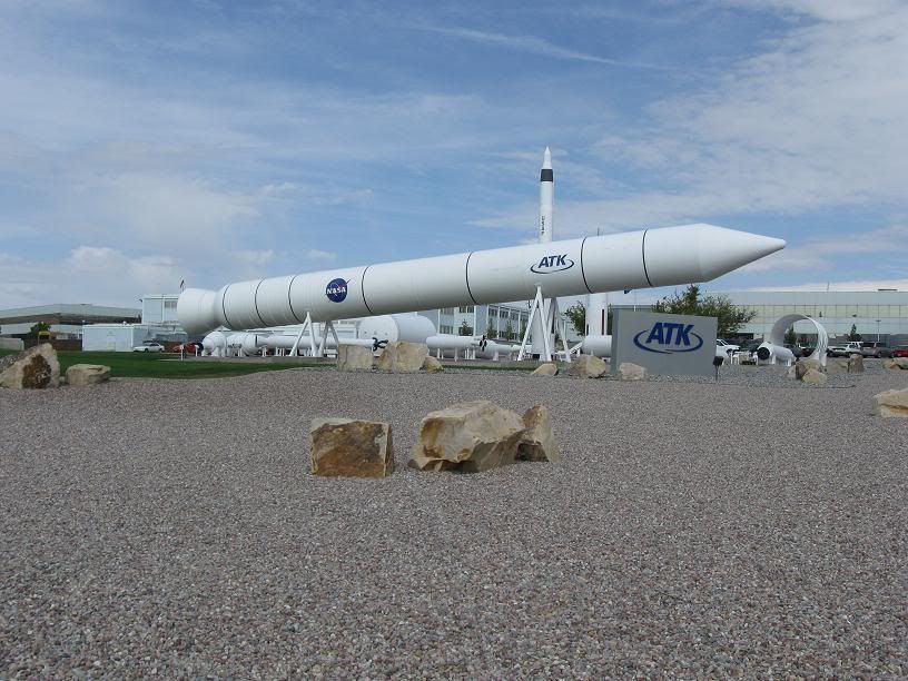
Below is a photograph I took last year, at the ATK Thiokol plant.
Continuing farther south, the Great Salt Lake becomes wider, and the salt flats approach closer to the Promontory Mountains.

Getting closer to Promontory Point, the Great Salt Lake continues to widen.

At Promontory Point, the Great Salt Lake gets much deeper. The photograph below was taken from Promontory Point, looking southeast, toward Antelope Island, on the horizon. Once again, the briny salt flats extend for a hundred yards or more, into the lake.

At this point, I decided to head east, across the Great Salt Lake, to Ogden. Rather than follow the railroad east, I decided to take a road that parallels some solar evaporation ponds, used to harvest potassium-bearing salts from the lake. Below is a photograph taken from the road, looking northeast, with the Wasatch Mountains reflected in the water. If you look closely, you can see some salt sticking to the underside of the Zong’s fender.

Looking to the south, you can see Antelope Island, with "saltbergs" floating in the briny water.


Here is a close-up view of Antelope Island, and the "saltbergs."


Getting closer to Ogden, the solar evaporation ponds get saltier.


Closer yet to Ogden, the solar evaporation ponds become large reservoirs of potassium-bearing salts. These enormous piles of salt are moved about by bulldozers, and transported by truck.

I passed a large pile of the harvested salt as I left the Great Salt Lake, and once again reached landfall, a few miles west of Ogden.

As the sun was setting, I traveled to Ogden to spend the night at Motel 6.
In my next installment I will continue my ride report as I head east, into the Wasatch Mountains, riding high above the Great Salt Lake Valley.
Spud